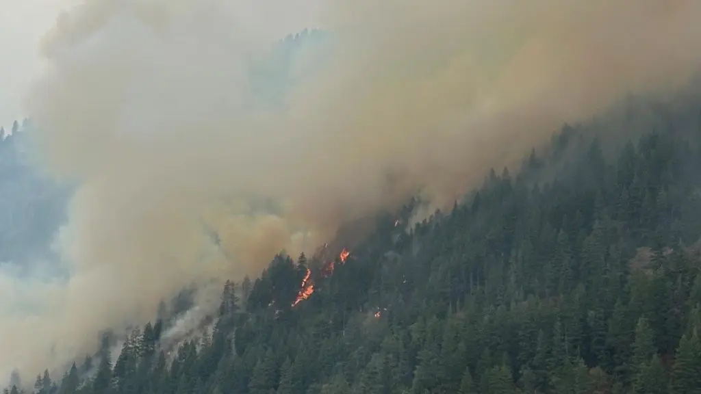
COEUR D’ALENE, ID – The Sunset Fire, burning on the western slope of Lake Pend Oreille, about 25 miles north of Coeur d’Alene, has grown to 3,208 acres with containment at 6 percent, according to Northern Rockies Team 5 Incident Commander Joe Sampson on Wednesday evening. The fire, which started on August 13, 2025, is under investigation.
A total of 621 personnel are assigned to the fire, including hotshots, type 2 hand crews, engines, and heavy equipment. Crews have worked to improve firelines along the western flank and to establish new lines on the northern flank. Aerial resources, including scoopers and helicopters, continue to support ground crews with water drops on the southern, western, and northern flanks. Watercraft have been used to insert crews into remote areas. An unmanned aircraft system (UAS) with infrared capabilities is monitoring hotspots and residual heat.
Fire behavior has increased as temperatures reached the mid-80s and relative humidity dropped to the low 20s, resulting in visible smoke from burning larger fuels. Continued hot and dry conditions are expected to increase potential fire activity, with primary spread projected north toward Talache Road and west into Maiden Creek. Smoke from the fire is likely to be visible from multiple locations.
The Bonner County Sheriff’s Office has updated the list of roads in the GO and SET evacuation zones. These updates replace previously posted information dated August 18. Residents can find the current road lists on InciWeb and are encouraged to sign up for Nixle alerts by texting 888777 with their zip code.
An evacuation center has been opened at the Cocolalla Bible Camp for displaced residents. The Bonner County Fairgrounds are available to shelter evacuated livestock on a limited basis.
Closures are in effect on the Idaho Panhandle National Forests. The closure covers all National Forest Service Lands along the western shoreline of Lake Pend Oreille from Camp Bay south to Three Sisters Horizontal Control Station, west to Three Sisters Creek, north to just south of National Forest Service Road 230, northeast to Hickman Creek, east to the forest boundary, and north to Sagle Road, then east back to Camp Bay.