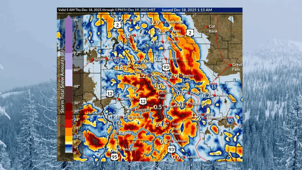
LEWISTON, ID – The National Weather Service says an atmospheric river will bring significant mountain snow to parts of north-central Idaho from Thursday into Friday, with winter travel impacts expected through Saturday morning. Forecasters say a plume of subtropical moisture will move into the region, producing heavy snow at higher elevations.
Snow levels are expected to rise above 5,000 feet Thursday night before dropping quickly Friday morning as a strong cold front passes. A Winter Weather Advisory remains in effect from noon Thursday through 10 a.m. Saturday for the Dixie, Elk City, and Highway 12 corridor from Lowell to Lolo Pass.
The heaviest snowfall is expected at elevations above 6,000 feet, particularly in the Clearwater and Bitterroot Mountains. The advisory calls for 8 to 14 inches of snow in higher elevations, including Lolo Pass, with 3 to 7 inches possible at lower elevations. Wind gusts may reach up to 40 miles per hour.
The National Weather Service warns of moderate winter weather impacts, including hazardous travel conditions and disruptions to normal activities. Motorists are urged to use extra caution while driving in affected areas.